
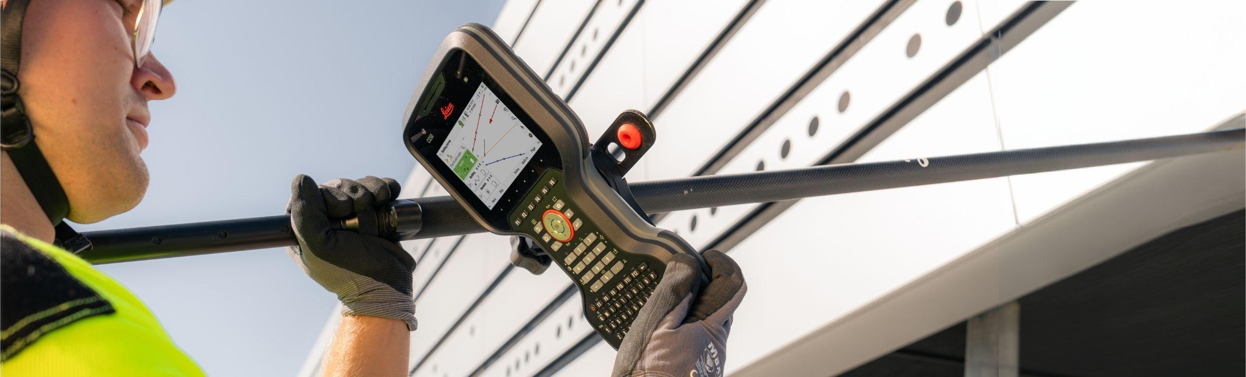
Leica CS50 Field Controller
The backbone of field performance
The Leica CS50 is the field controller built for surveying with Leica Captivate. Delivering reliable performance in tough field conditions, it handles large datasets, and demanding workflows with ease. By keeping instruments, software, and cloud connected, it helps surveyors stay productive, in control, and ready for the next job.
Designed for the field
Work confidently throughout the day with an ergonomic, one-handed design, tactile backlit keypad, and bright display. IP66/68 protection keeps the CS50 ready for demanding field conditions.
Built for productivity
Work smoothly with large datasets, CAD files, IFC models, and imagery. Fast, responsive performance keeps you moving between applications and job data.
Ready for more
Stay connected across networks and regions with physical SIM and eSIM support. The integrated DISTO™ lets you measure remote or inaccessible points without repositioning.
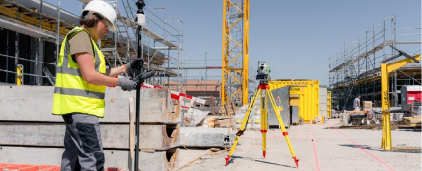
Stay ready throughout your workflow
Prepare
Use Leica Infinity to prepare your data before heading to the field. Import designs, define coordinate systems, and adjust jobs. Then transfer everything to the CS50 via Hexagon GeoCloud, ready to work in Leica Captivate.
Measure and stake
In the field, use the CS50 with Captivate to measure, visualise, and check your data in 3D. Responsive performance, a bright display, and tactile keypad keep you in control throughout the job.
Transfer data
Send collected data directly from the CS50 to GeoCloud. Your data is securely stored in the cloud and ready for office teams to check or start processing, with no delays and no data gaps.
Process and deliver
Continue your work in Infinity, combining field data with information from other survey instruments. Use CAD drafting to create your survey notes, export to BIM and CAD applications, or send data back to the CS50 in the field.
Why the CS50 is ready for demanding fieldwork
Get more done directly in the field
Do more without changing your setup. The integrated DISTO™ lets you capture remote or inaccessible points directly from the pole. The large display, tactile backlit keypad, and powerful hardware help you stay productive and in control in the field, and keep demanding survey data and applications running smoothly.
Depend on it when the job gets demanding
Keep working with a field controller designed for professional surveying. The IP66 and IP68 level protection, durability verified through MIL-STD-810H standard testing, a bright display, and a keypad designed for use with gloves and in wet conditions help keep the CS50 performing across challenging field conditions.
The Leica Geosystems-managed Linux operating system provides a stable and controlled environment with predictable software behaviour even when jobs get more complex. Fast system response when switching between apps, datasets, and tasks means less waiting between setup, measuring, and staking, so workflows don’t stall.
Stay connected from field to office
Keep data and teams moving wherever the job takes you. 5G connectivity, a physical SIM card, and eSIM support provide flexible connectivity across regions and deployments.
Together with Captivate and GeoCloud, the CS50 makes it easier to transfer project data between field and office and keep surveying workflows connected.
With Control in GeoCloud Fleet, compatible total stations and the CS50 can stay connected over the internet, extending communication beyond traditional Bluetooth limitations and giving surveyors more flexibility in how they work.
Downloads / White Papers
Servicing and Repair
Your trusted partner for all your surveying, safety, and cable locator needs.
Used Equipment
Your trusted partner for all your surveying, safety, and cable locator needs.


